Remote Sensing - Using Technology to Search for Shipwrecks
Remote sensing is just one of the many tools maritime archaeologists use to help discover and explore for new maritime heritage sites. In May of 2010, remote sensing specialists from SEARCH, Inc. assisted Monument maritime archaeologists with magnetometer and side scan sonar surveys. These surveys helped to investigate large areas where ships may have been lost. The project was successful in documenting magnetic signatures of whaling vessels, as well as helping to find new maritime heritage sites at Lisianski Island and Kure Atoll. Several new anomalies were recorded and have yet to be identified. The SEARCH team also developed several side scan sonar mosaics of known sites that help to refine what we know about the seafloor around these sites. http://searchinc.com
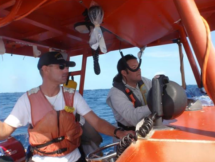
Jason Kehn and Michael Krivor conduct remote sensing survey at Midway Atoll. Credit: NOAA/Gleason.

Jason Burns and Michael Krivor collect data as Jason Kehn cox’ns HI-2 at Midway Atoll.
Credit: NOAA/Gleason.
Co Trustees |
World Heritage |
Big Ocean |
Contact Us Link Disclaimer User Survey Privacy Policy |
Revised December 5, 2022 by PMNM Webmaster Web site owner: National Ocean Service Office of National Marine Sanctuaries National Oceanic and Atmospheric Administration Main Office: NOAA/Daniel K. Inouye Regional Center NOS/ONMS/PMNM, 1845 Wasp Blvd, Building 176 Honolulu, HI 96818 | Phone: 808-725-5800 | Fax: 808-455-3093 |