The 2014 RAMP Expedition to Papahānaumokuākea Embarks
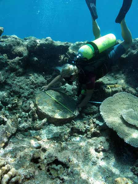
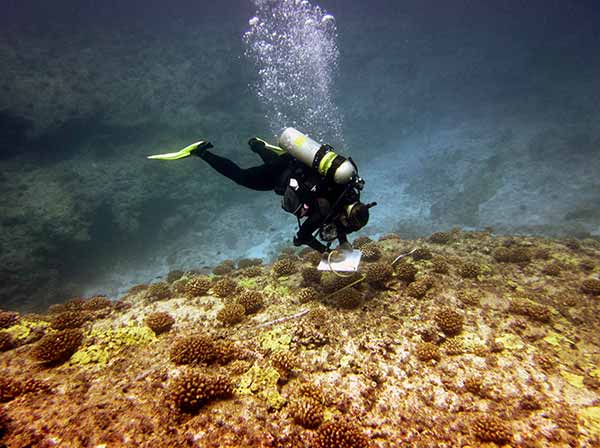 A researcher conducts a reef survey on Pearl and Hermes Reef. Credit: Scott Godwin/NOAA |
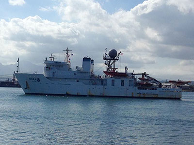
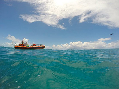
After a slight delay due to hurricane activity in the Pacific, the 2014 Reef Assessment and Monitoring Program (RAMP) expedition to the Northwestern Hawaiian Islands will take place from August 11 through 31 aboard NOAA Ship Hiʻialakai. Researchers will visit French Frigate Shoals, Midway Atoll and Lisianski Island within Papahānaumokuākea Marine National Monument to conduct various research activities.
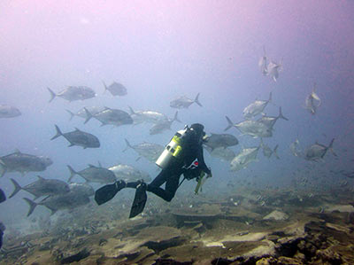
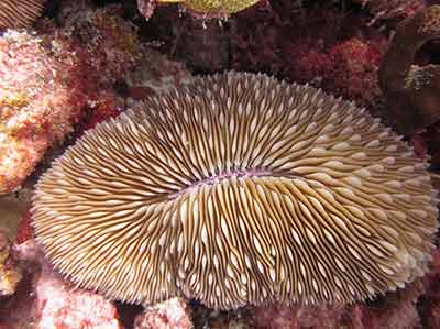
Monitoring reef fish, algae, corals and other invertebrates
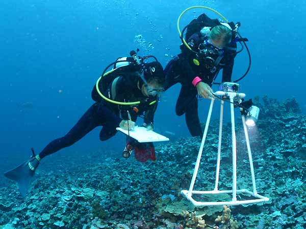
Researchers conduct a reef survey using a photo quadrat in the Northwestern Hawaiian Islands. Credit: James Watt
Divers will conduct rapid ecological assessments (REAs) of reef fish, corals and other invertebrates to improve our understanding of the health of coral reef ecosystems throughout the archipelago. Four distinguished students from the University of Hawaiʻi are participating in the reef monitoring operations this year. They were selected through a partnership with UH’s Marine Options program and specially trained by PMNM field staff in preparation for this work. Rapid ecological assessments have been conducted in the NWHI since 2000. Long-term monitoring provides information that helps managers make decisions about Monument management.
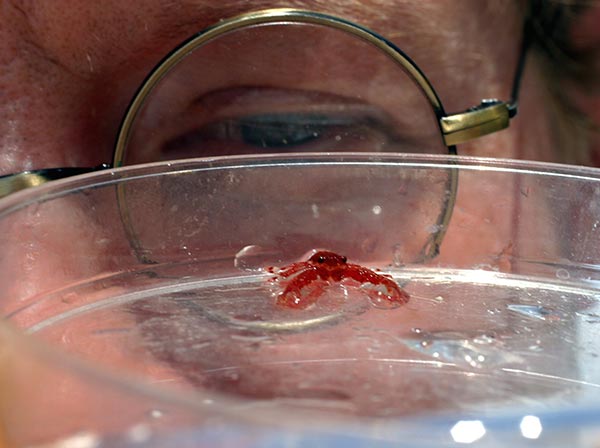
Coral disease and prevalence
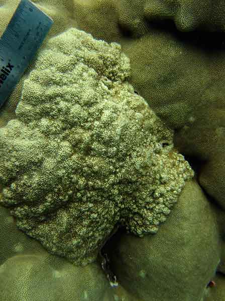
Growth anomaly on lobe coral (Porites lobata) in the Main Hawaiian Islands. Credit: Courtney Couch
Large marine protected areas such as PMNM provide a unique opportunity to study the effects of climate change on coral diseases and overall reef health in the absence of local man-induced stressors. Divers will conduct surveys to determine how extensively diseases are affecting the Northwestern Hawaiian Islands to help managers identify and target coral disease hot spots, determine whether coral health is changing over time, and explore the extent to which disease is influencing coral communities and overall reef health in the Monument.
Bioerosion
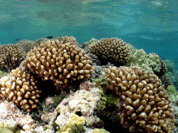
Cauliflower Coral (Pocillopora sp.) at Maro Reef in the Northwestern Hawaiian Islands. Credit: James Watt
This project, which began in 2011, seeks to characterize the marine organisms that naturally erode coral reefs and test theories on its acceleration due to climate change. A dive team will retrieve previously deployed calcium carbonate blocks at existing sites to study back in the lab and compare bioerosion rates from these blocks against previously collected ones. The dive team will also collect samples of dead coral skeleton and survey for sea urchins, which graze on corals, to assess the relationship between coral erosion and urchin grazing.
Coral Cryptofauna
Researcher examines an undescribed squat lobster (Galathea sp.) in the Northwestern Hawaiian Islands. Credit: James Watt
Working in conjunction with the bioerosion study described above, this project is testing methods to collect and quantify cryptic (hidden) fauna (animals) that dwells within living and dead corals. Divers will conduct surveys of specific sites, deploy GoPro cameras to investigate species interactions, and collect tissue samples from key species (such as scorpionfish and trapezid crabs) for genetic analysis to study connectivity patterns between animals.
Maritime Heritage
Dr. Kelly Gleason documents a grinding stone at the Two Brothers shipwreck site. Credit: Smith/NOAA
Maritime archaeology operations will include continued monitoring of known shipwreck and sunken aircraft sites and towboard surveys to search for potential new finds in areas of probable loss. Maritime archaeology surveys provide information that helps to better interpret and preserve these resources and allow management agencies to meet their shared federal mandates in historic preservation. In addition, information collected contributes to the continued development of exhibits and other outreach products to share these finds with the public. Of the possible 126 shipwreck and historic aircraft lost in the area, 21 have been confirmed by field investigation. To date, surveys of twelve of these 21 have been completed in the NWHI.
All of these research activities improve our understanding of the region's marine systems and features and help us to better manage the Monument.
Regular updates from the cruise will be posted on this page, as well as our Facebook site.
Expedition Log |
| by Toni Parras, PMNM Communications Manager |
Click on the date below to learn more about the daily events.
 |
August 11, 2014 Meet the Participants |
 |
August 13, 2014 Safety First |
 |
August 15, 2014 First Stop: French Frigate Shoals |
 |
August 20, 2014 What is RAMP, exactly? |
 |
August 21, 2014 Evidence of Historic Seaplane Mooring Area Found at French Frigate Shoals |
 |
August 23, 2014 Team ‘Pomerosion’ by guest blogger Emily Gaskin, 2014 RAMP Data Manager |
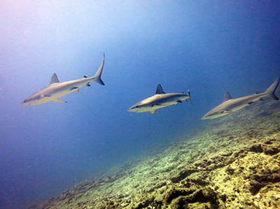 |
August 25, 2014 The Real Shark Week |
 |
August 27, 2014 The Seen and Unseen by 2014 RAMP Chief Scientist Scott Godwin |
Co Trustees |
World Heritage |
Big Ocean |
Contact Us Link Disclaimer User Survey Privacy Policy |
Revised December 5, 2022 by PMNM Webmaster Web site owner: National Ocean Service Office of National Marine Sanctuaries National Oceanic and Atmospheric Administration Main Office: NOAA/Daniel K. Inouye Regional Center NOS/ONMS/PMNM, 1845 Wasp Blvd, Building 176 Honolulu, HI 96818 | Phone: 808-725-5800 | Fax: 808-455-3093 |