Native Hawaiian Scientists depart for Papahānaumokuākea
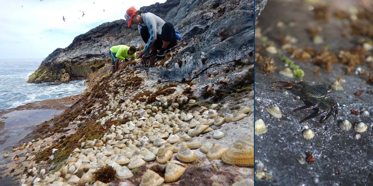
Left: Researchers count ʻopihi, or Hawaiian limpets, along the rocky shorelines at Gardner Pinnacles. ʻOpihi prefer the wave exposed rock in the intertidal zone where they feed on algae (Image: Kim Morishige). Right: Rock crabs, or aʻama, are common in the spalsh zone in both the main and northwestern Hawaiian islands (Image: Brad Ka‘aleleo Wong/OHA).
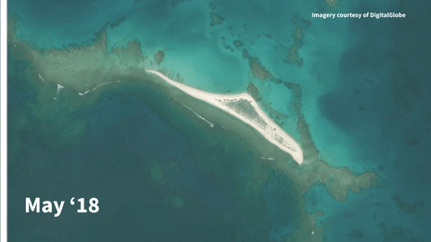
The before and after satellite images of the impacts upon East Island from Hurricane Walaka in French Frigate Shoals. The first photo was taken in May 2018 and the second photo is from October 2018. Imagery courtesy of DigitalGlobe
A hui of Native Hawaiians departed from Kāneʻohe Bay on Saturday, July 31, to embark on a 15-day scientific research voyage into the Papahānaumokuākea Marine National Monument that is supported in part by the Office of Hawaiian Affairs.
Sailing aboard the Makani ʻOlu, a 96-foot, triple-masted schooner, the 12 Native Hawaiian researchers will visit the most eastern islands in the monument: Nihoa, Mokumanamana and Lalo (French Frigate Shoals).
Thank you for visiting a National Oceanic and Atmospheric Administration (NOAA) website.
You have chosen to proceed to a non-government website for additional information.
NOAA and the U.S. Department of Commerce do not endorse this website or the information, products or services contained therein.