
Midway Atoll is now "Streetviewable" via Google Maps
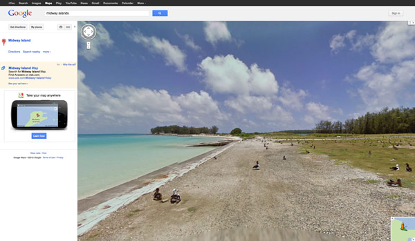
Screenshot of Midway Atoll on Google Streetview. Credit: Google Maps
Bringing "the place to the people" with Google Streetview
Internet users can now virtually stroll among the millions of seabirds and various historic sites on Midway Atoll (or, to use its Hawaiian name – "Pihemanu") using Google StreetView. PMNM teamed up with Internet giant Google using digital imagery and Web technology to bring Papahānaumokuākea to a broader audience in a way never before done, making good on our commitment to "bring the place to the people."
In a project spearheaded by the Monument, a team consisting of PMNM staff and a Google technician spent two weeks on Midway this summer, capturing more than 9,200 panoramic images of 60 different natural and historic sites along 21 miles of roads and paths on the island.
Midway boasts the largest nesting colonies of Laysan and Black-footed albatrosses in the world, and supports the first successfully reintroduced population of endangered Laysan ducks - the most endangered waterfowl in the Northern Hemisphere. The atoll and surrounding seas were the site of a pivotal battle of World War II, and Midway was an active Navy installation during the Cold War.
In addition to being part of Papahānaumokuākea Marine National Monument, Midway Atoll is a National Wildlife Refuge, established in 1988, and site of the Battle of Midway National Memorial.
This mapping effort provides a valuable interpretive tool for Papahānaumokuākea's unique treasures and demonstrates the need to protect this remote and special place. We hope for a continued partnership with Google to capture other sites within the Monument.
Streetview Instructions:
- Go to Google Maps and type in "Midway Islands" (we are in the process of correcting this to "Midway Atoll")
- At the top of the zoom bar on the map is an orange "Streetview" person icon
- Left click hold and drag the orange person icon over the map (this will light up the Streetview paths)
- Drop the orange person on the blue line path that interests you.
- Use your mouse or keyboard arrows to navigate when in Streetview and enjoy!
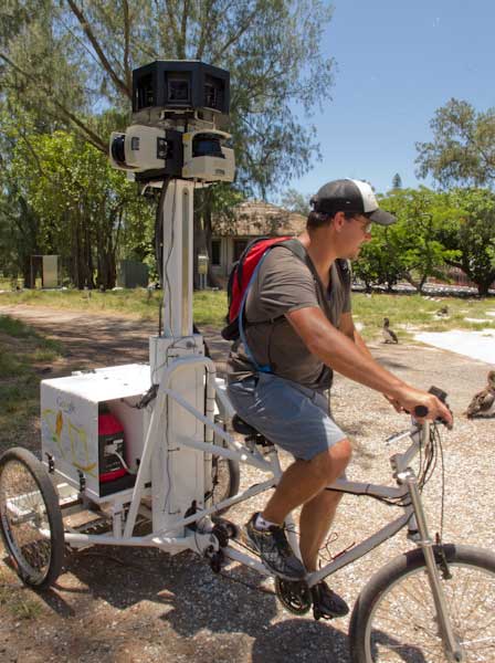
Using the Google Trike, PMNM staff captured images across the island. Credit: Richard H. Batcheldor, Jr./NWReflections

Google Streetview Mapping Team in action on Midway. Credit: Virginia Branco/NOAA
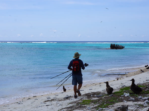
Google Streetview Mapping Team on the coast on Midway. Credit: Virginia Branco/NOAA