Scientists – and the Public – explore the Deep-Water Habitats of PMNM
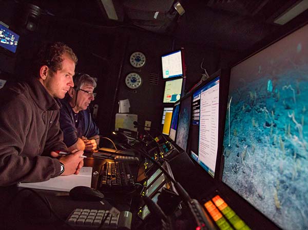 Expedition science leads Christopher Kelley (background) and Daniel Wagner (foreground) monitor an ROV dive in the science control room of the Okeanos Explorer. Credit: NOAA Office of Ocean Exploration and Research, 2015 Hohonu Moana |
On August 23, NOAA ship Okeanos Explorer returned from a 24-day expedition that explored deep-water habitats in Papahānaumokuākea Marine National Monument (PMNM) as part of a four-leg mission called “Hohonu Moana: Exploring Deep Waters off Hawaiʻi.” Since over 98% of the area of PMNM lies at depths below 100 meters (more than 300 feet), most of the Monument’s deep-water ecosystems have remained virtually unexplored. This expedition sought to provide baseline information on these largely unexplored deep-water environments in order to support management and research efforts of the Monument.
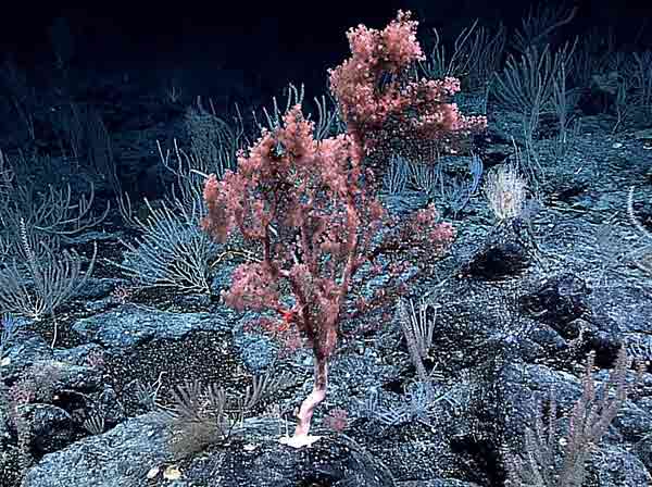 A high-density community of deep-sea corals and sponges at a depth of 2,000 meters (that’s more than a mile deep!) surveyed during the expedition. Credit: NOAA Office of Ocean Exploration and Research, 2015 Hohonu Moana |
The expedition team used NOAA's two-body remotely operated vehicle (ROV) system to conduct 18 dives for a total of 95 hours of bottom time, some as deep as 4,829 meters – which is almost 16,000 feet, or 3 miles down! These included the deepest dive ever conducted inside the Monument. Many of the ROV surveys focused on identifying and characterizing vulnerable deep-water marine environments, particularly high-density communities of deep-sea corals and sponges. The dives discovered seven new high-density communities inside PMNM, and extended the depth and geographic range of three previously known ones.
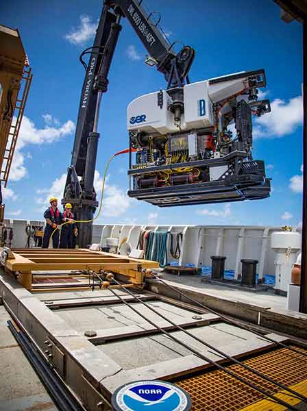 The ROV Deep Discoverer being brought back on deck of the Okeanos Explorer after a successful dive. Credit: NOAA Office of Ocean Exploration and Research, 2015 Hohonu Moana |
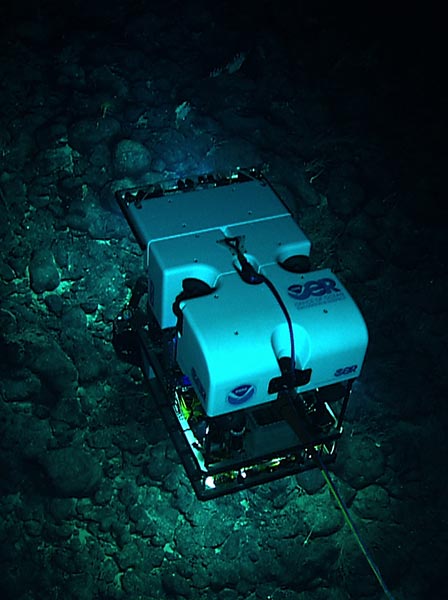 The ROV Deep Discoverer explores the deep waters of the Monument. Credit: NOAA Office of Ocean Exploration and Research, 2015 Hohonu Moana |
The expedition also included the first-ever collection of physical specimens by the Okeanos Explorer since the exploratory research vessel was launched in 2010. A total of 90 specimens were collected, including 58 biological samples, 35 of which represent either likely new species to science or new records to the region. The expedition also made use of the Okeanos Explorer's multibeam sonar systems to generate high-resolution maps for more than 29,000 km2 of seafloor in the Northwestern Hawaiian Islands, including three seamounts inside PMNM that had never been mapped before.
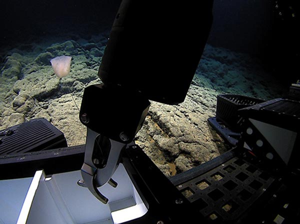 The manipulator arm of the ROV Deep Discoverer places an unidentified sponge in a sampling drawer. Credit: NOAA Office of Ocean Exploration and Research, 2015 Hohonu Moana |
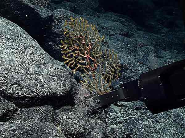 A specimen of a gorgonian coral never before been recorded in the Hawaiian Islands being collected. Credit: NOAA Office of Ocean Exploration and Research, 2015 Hohonu Moana |
A particularly fascinating aspect of this expedition was the ability for not only land-based scientists but the public to take part in the ROV dives via live streaming video feeds. The team onboard the Okeanos used a high-bandwidth satellite connection to stream data to shore-based exploration command centers, where scientists from around the world were able to participate in the expedition in real time. A total of 45 shore-based scientists from the U.S., Japan and Canada participated. In addition, the dives were broadcast over the Internet in real time, with lively commentary from the chief scientists, Dr. Christopher Kelley from NOAA's Office of Exploration and Research, and Dr. Daniel Wagner from PMNM. The live video feeds garnered more than 400,000 views over the course of the expedition.
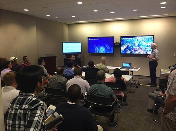 NOAA Pacific Islands Fisheries Science Center (PIFSC) Fishery Biologist Bruce Mundy gives background information to folks from the Asia-Pacific Center for Security Studies at the Expedition Command Center at NOAA's Inouye Regional Center in Pearl Harbor. Credit: Ensign Nick Pawlenko, NOAA Commissioned Officer Corps |
To see more amazing images and video clips, visit the Okeanos Explorer Leg 2 webpage: http://oceanexplorer.noaa.gov/okeanos/explorations/ex1504/background/media-resources/media/leg2.html.
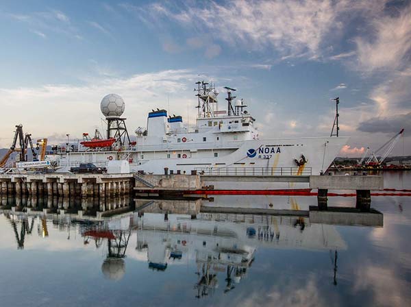 NOAA Ship Okeanos Explorer docked at Pearl Harbor. Credit: NOAA Office of Ocean Exploration and Research, 2015 Hohonu Moana |
Co Trustees |
World Heritage |
Big Ocean |
Contact Us Link Disclaimer User Survey Privacy Policy |
PMNM Webmaster Web site owner: National Ocean Service Office of National Marine Sanctuaries National Oceanic and Atmospheric Administration Main Office: NOAA/Daniel K. Inouye Regional Center NOS/ONMS/PMNM, 1845 Wasp Blvd, Building 176 Honolulu, HI 96818 | Phone: 808-725-5800 | Fax: 808-455-3093 |