|
Ocean Productivity
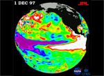
In the Northwestern Hawaiian Islands ocean productivity has been linked to large scale fluctuations in sea surface temperature and related oceanographic and atmospheric conditions.
Read more... |
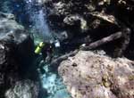
Seamounts, Guyots and Banks
Although land areas are very limited in the Northwestern Hawaiian Islands at less than six square miles, the relatively shallow underwater habitats (0 – 600 feet below the surface) are extensive.
Read more... |
Fresh water lens
Access to fresh water is the primary limiting factor for terrestrial plants and animals living on the small Northwestern Hawaiian Islands.
Read more... |
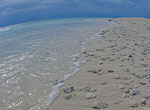
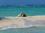
Sand
You can tell a lot about the geology of a seaside area by its sand.
Read more... |
High Islands
The Hawaiian Archipelago is composed of "high" islands, and low-lying islands and atolls.
Read more... |
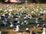
By Wind, Wave and Wing
The Hawaiian Archipelago is the remotest island chain on Earth, with the closest continental land mass 2,600 miles away.
Read more... |
Kuroshio Current
The Kuroshio Current is one of the primary large-scale currents that affect the Northwestern Hawaiian Islands.
Read more... |
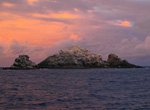
Coral rubble islets
In atoll environments coral fragments and sand are distributed by currents and wave energy and pile up to create coral-rubble islets.
Read more... |
Spur and groove reefs
One of the effects of large waves on reefs is the formation of spur-and-groove topography.
Read more... |
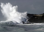
Large wave events
The Hawaiian Islands are famous for their epic waves, particularly along the island's northern shores.
Read more... |
Tropic of Cancer at Mokumanamana
Mokumanamana sits just north of the Tropic of Cancer, a circle of latitude around the Earth that marks the northern-most position of the sun where it appears directly overhead at its zenith.
Read more... |
PMNM Size Matters
Papahānaumokuākea Marine National Monument and World Heritage Site is one of the largest fully protected conservation areas in the world.
Read more... |
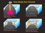
Atoll formation
The only coral atolls in the United States are found in the Northwestern Hawaiian Islands, and Kure Atoll is the northernmost atoll in the world.
Read more... |
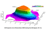
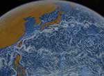
Ancient seafloors
The high resolution seafloor topography data shown in this image reveals the flat-topped nature of many of the seamounts and atolls in the Northwestern Hawaiian Islands (NWHI).
Read more... |
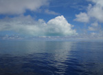
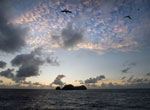
Atoll Reflection on Clouds
Shallow waters of atoll lagoons reflect sunlight back onto low lying clouds, coloring their undersides torquiose or green.
Read more... |